American Toxics
In spring 2025, I discovered that my preschool in my beautiful hometown of State College, PA was next to a toxic waste site. And 23% of Americans live within 3 miles of one of the 1,800+ toxic sites in the U.S. at which the federal government (slowly) manages cleanup. Meanwhile, relevant tools and documentation are rapidly disappearing from government websites.
I began by building americantoxics.com, a website that maps every high-priority Superfund site. I used GPT-4.1 to summarize the documentation in government archives, and made a website with a clear map of every site. It’s open source.
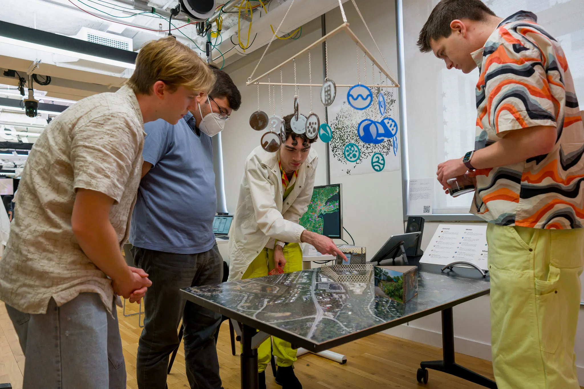
As part of my thesis project at NYU IMA, this project morphed into a full gallery installation. Across 8 pieces, spanning a 50-foot timeline, large-format prints, a satellite map, sound, a hanging mobile of laser-cut icons, a jar of toxic sludge, and more, I presented the scale of these sites nationwide and zoomed in on this story surrounding my preschool. The installation was exhibited at the ITP Spring Show 2025 in Downtown Brooklyn for thousands of visitors.
My live thesis presentation, May 2025.
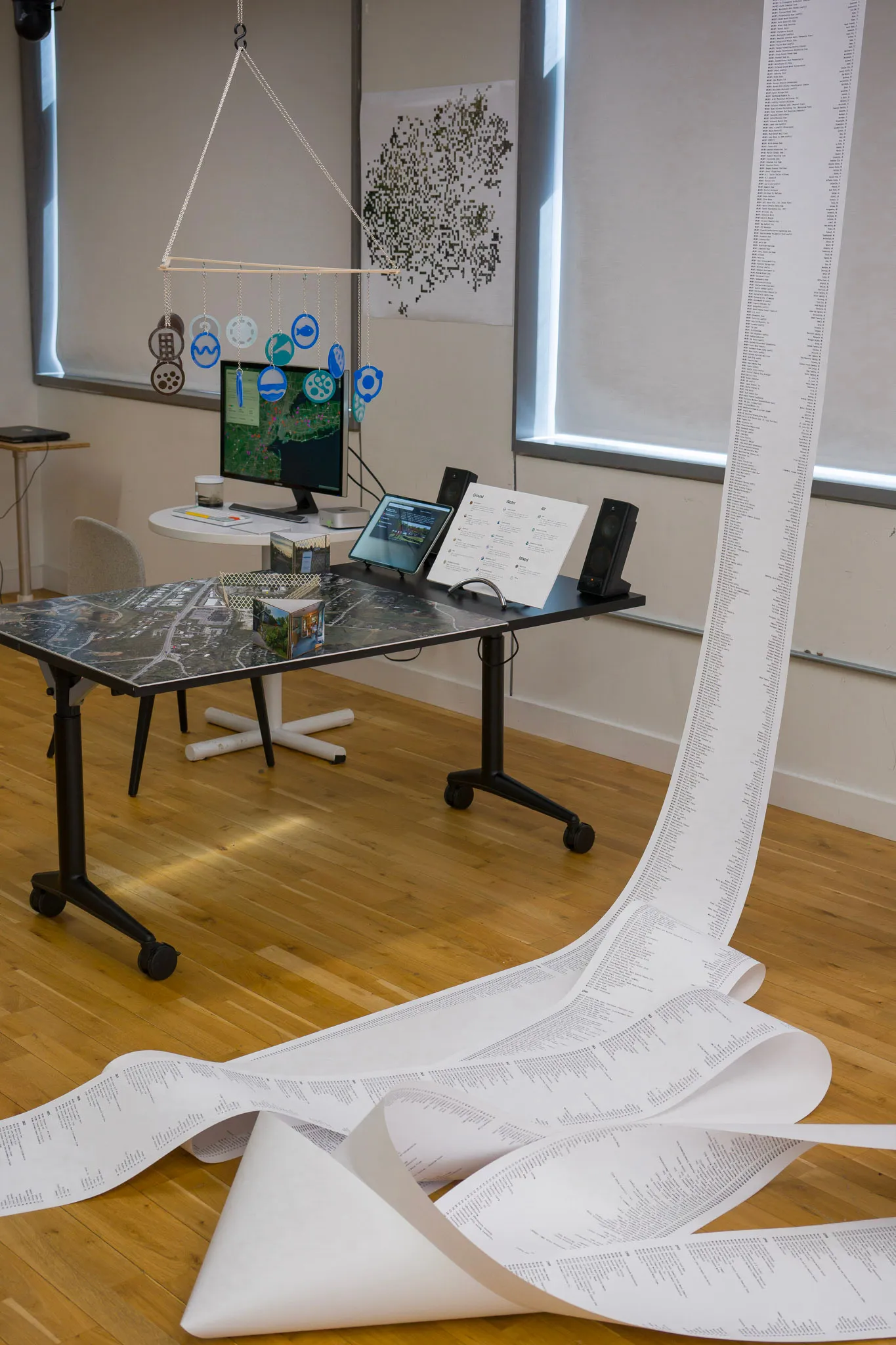
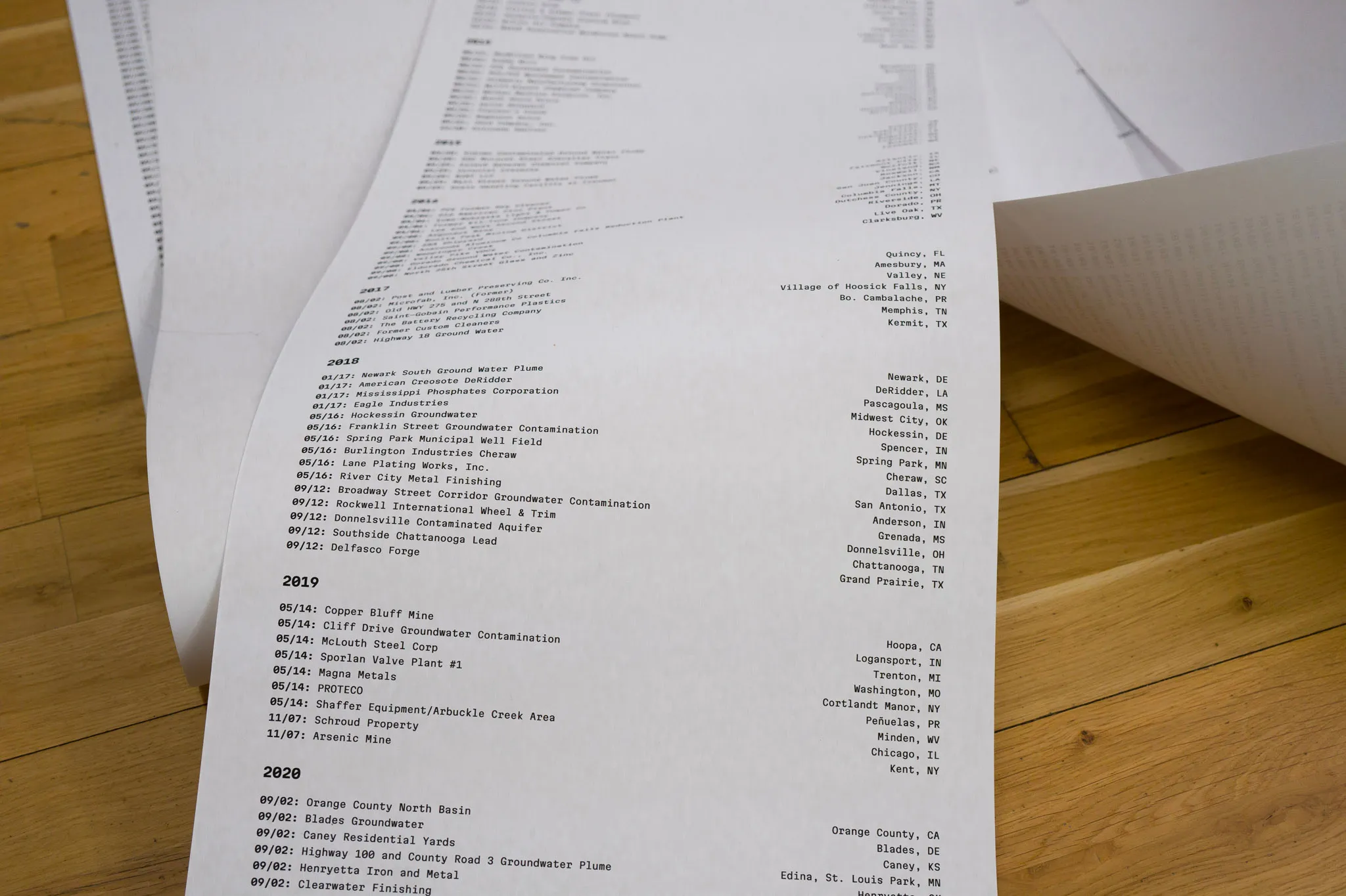
Timeline
A 50-foot chronological timeline of all nearly 2,000 Superfund sites as they were officially listed by the EPA, all printed on one roll of paper.
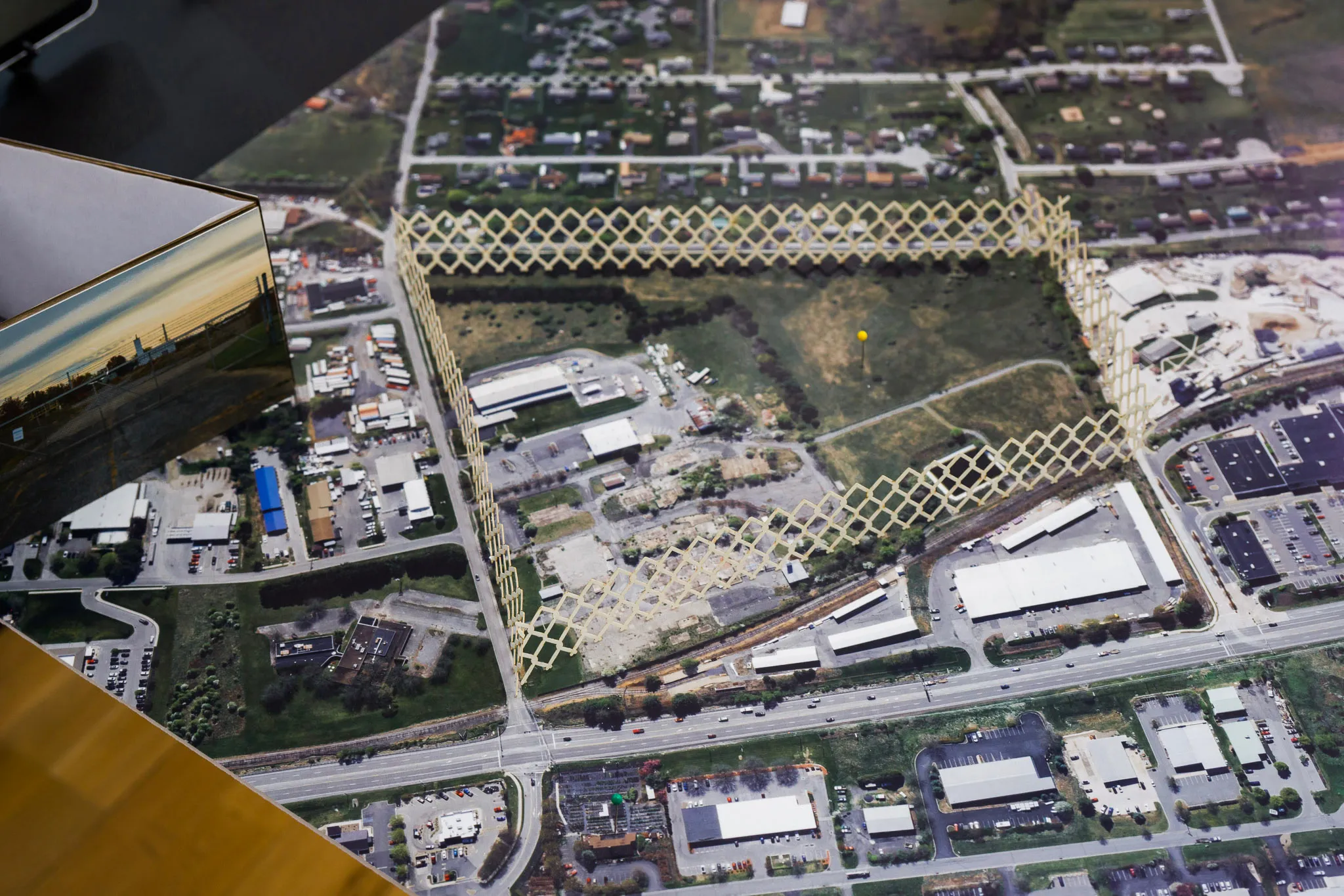
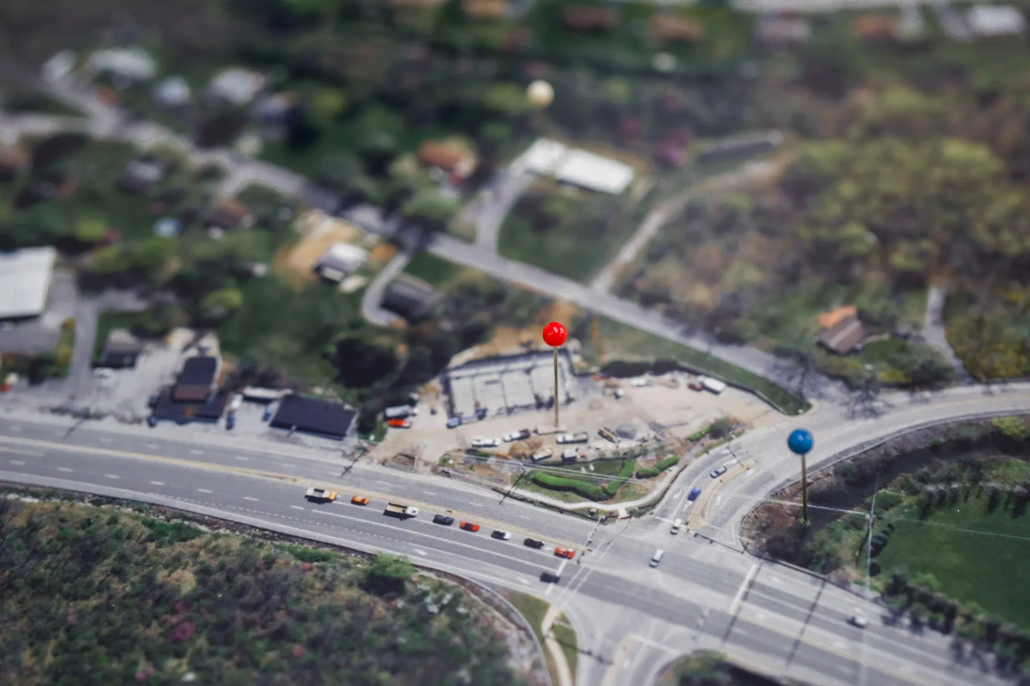
Centrepiece
A high-resolution satellite map of my hometown in Centre County, PA, centered on my preschool, is printed 40” square. A 3” laser-cut map of Pennsylvania orients viewers. A laser-cut fence outlines the Superfund toxic waste site. Two photo installations show me at my preschool in the early 2000s and the Superfund site, respectively. Pins guide viewers through an associated AR guide. In the background, a 30-minute field recording from the site plays on loop. (Photos of the site and field recording by Alexis Oltmer.)
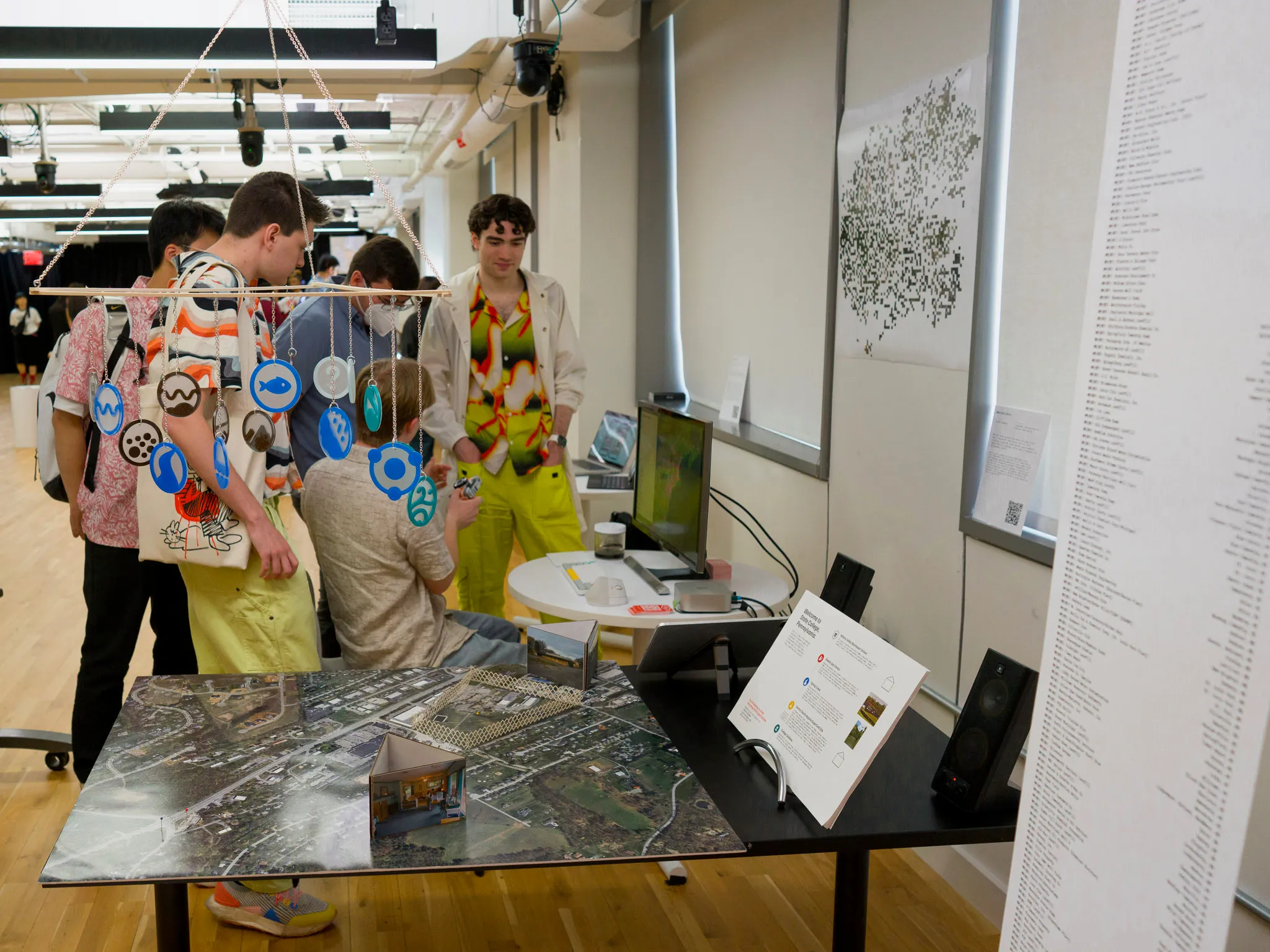
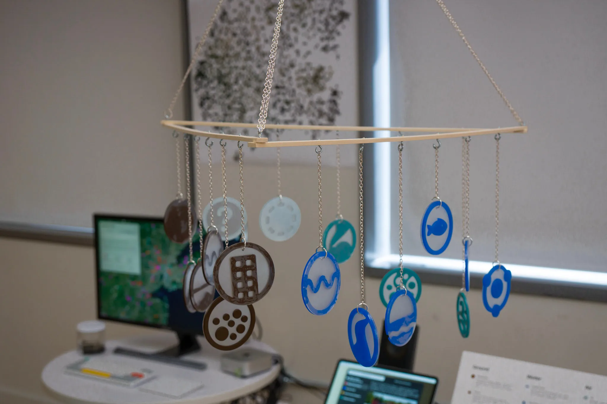
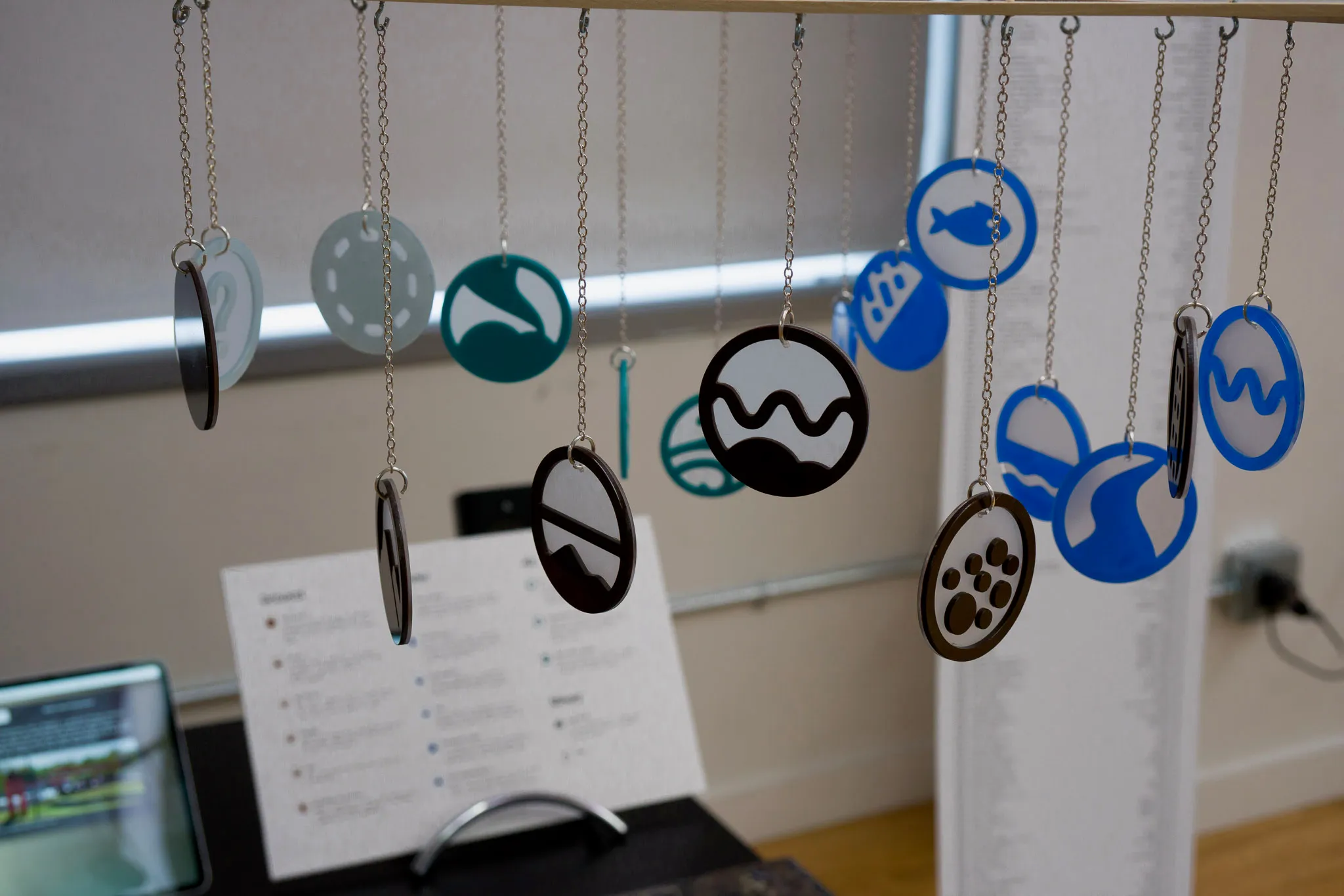
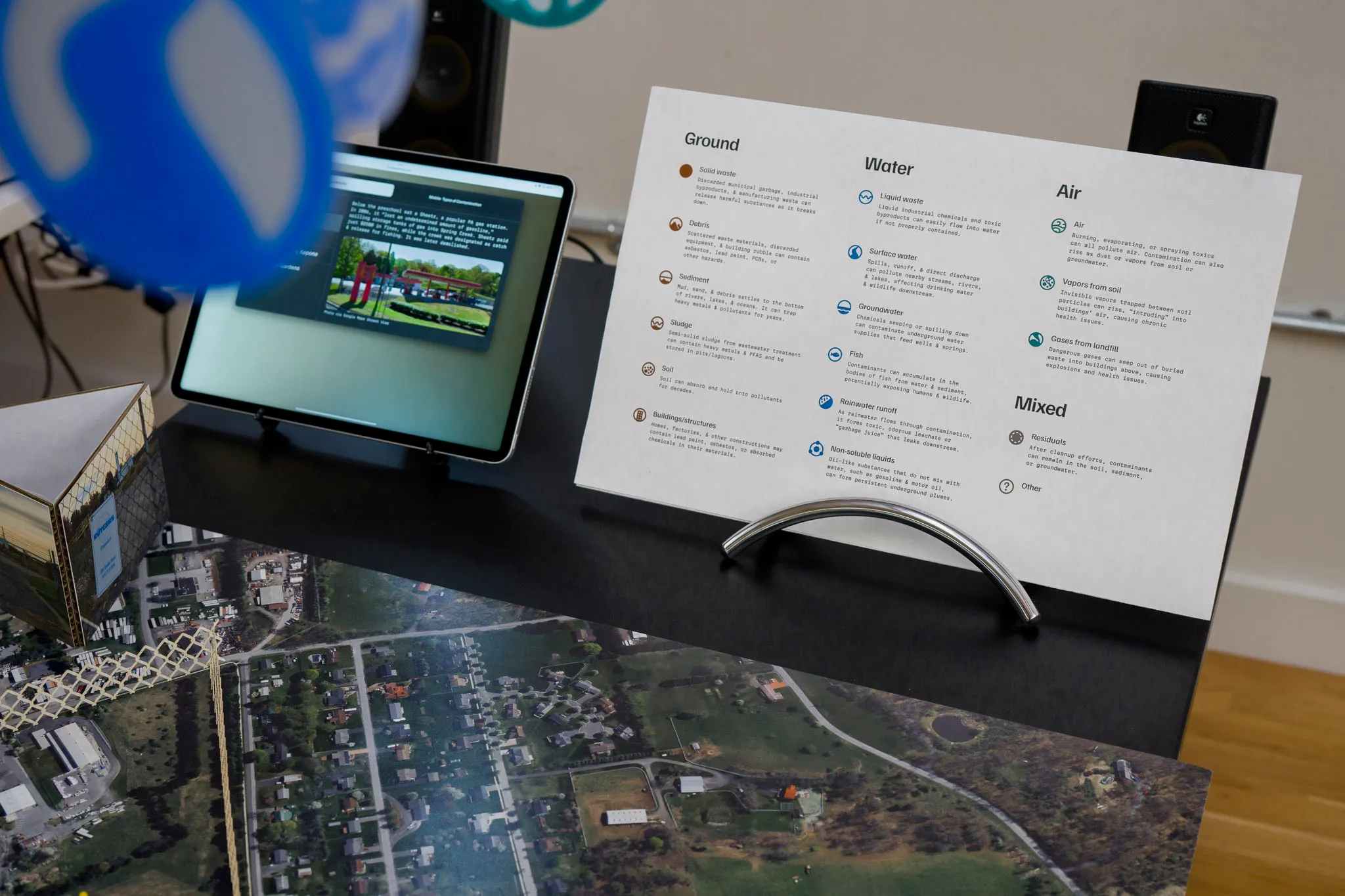
Mobile
Above the map of my preschool, a mobile hangs. Custom icons designed to represent all 17 “contaminated media” by the EPA (groundwater, soil, air pollution, etc). Each icon is laser cut from acrylic, grouped by ground/water/air, and strung from a wooden mobile.
A custom guide to these types of contamination is printed on a board for viewers.
Sludge Desk
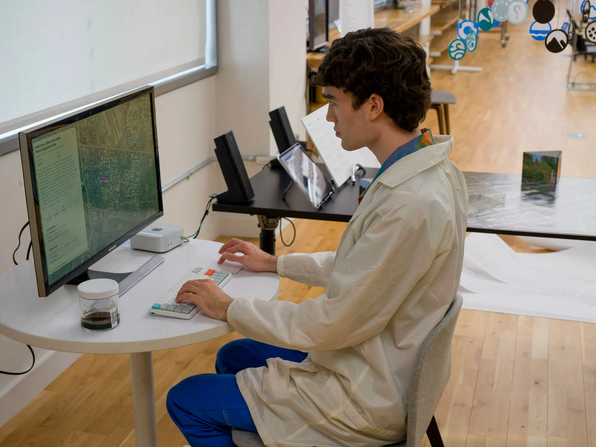
At a small desk, viewers can browse the map/website.
A glass jar of toxic sludge from the nearest Superfund site, Gowanus Canal, sits next to the keyboard & trackpad.
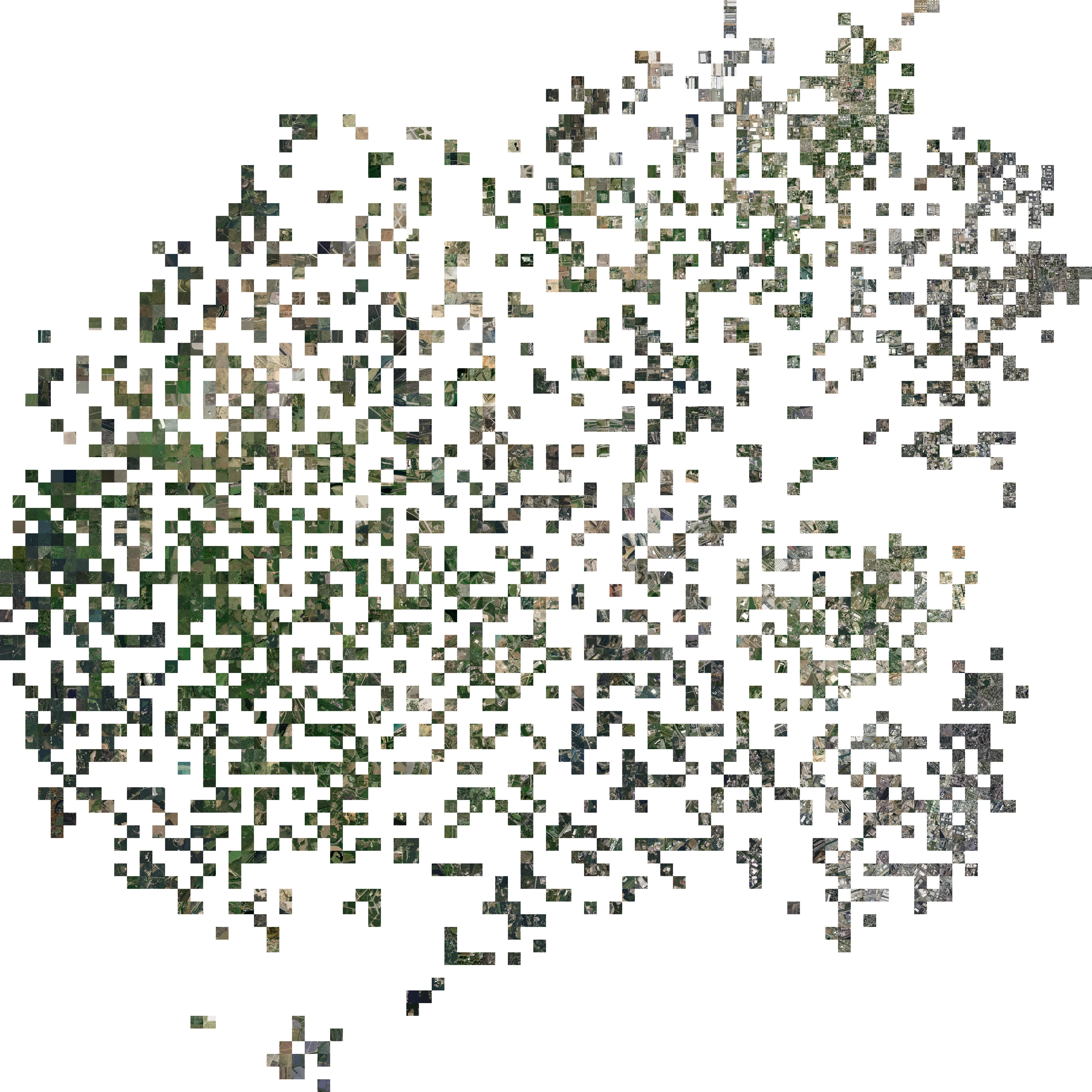
Land Clusters
A satellite tile from each of the 1800+ Superfund sites in the U.S. is grouped by visual similarity with the t-SNE machine learning algorithm, revealing what contaminated land tends to look like. Printed large-format (42”) and wall-mounted.